
arrow_backBack
Gravel bike
Along the river
landscape Easy
route 39.75 kilometers
trending_up 1115 metres
trending_down 1115 metres
Starting from the charming village of Rossinière, this itinerary takes you to discover our mountain lakes and rivers. Let yourself be guided by the sound of the water which will be your companion throughout this loop!
Difficulty
nearbynearbynearbynearbynearby
Best season
emoji_nature
Spring
sunnySummer
parkFall
Highest point
arrow_upward1411 metres
Lowest point
arrow_downward798 metres
Route Information
Start - Along the river

Arrival - Along the river
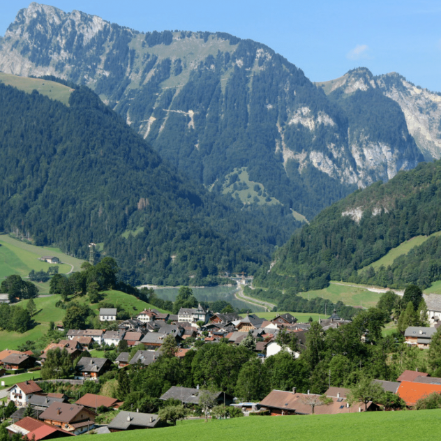
Rossinière
The village of Rossinière will charm you with its architectural landscape and its secrets.
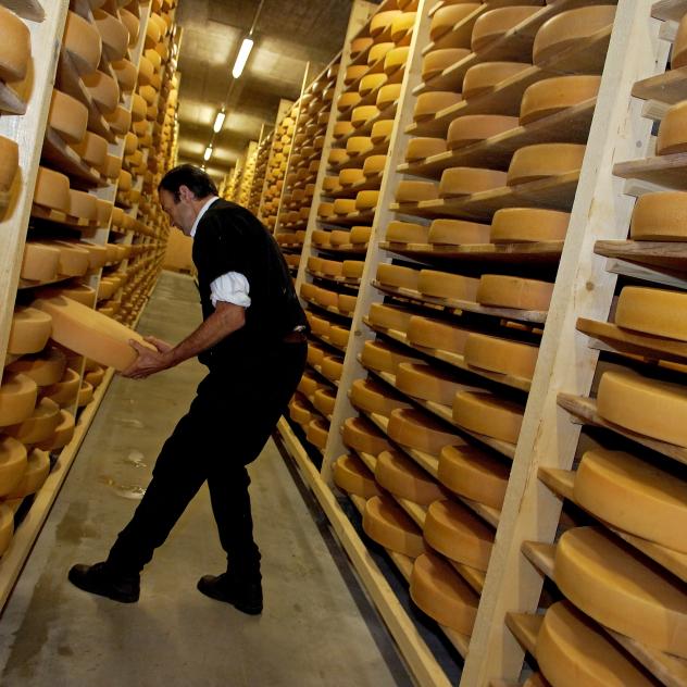
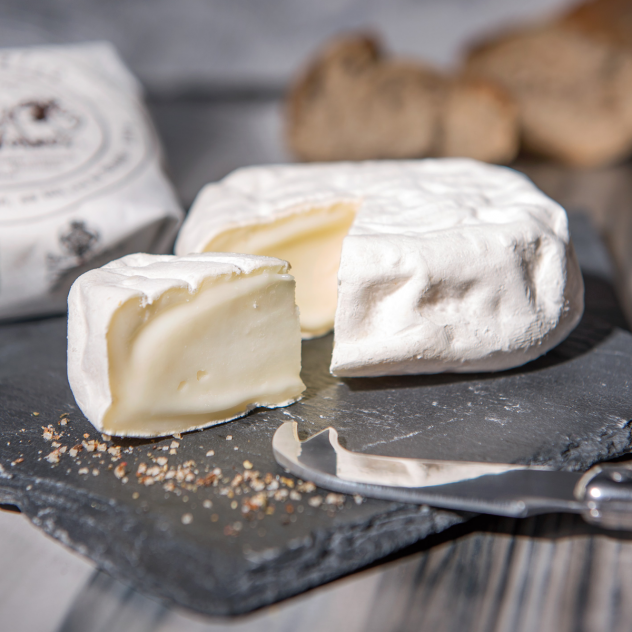
Cheese cellars of L'Etivaz AOP
The cheese cellars, located in l'Etivaz, allowed you to learn all about the secrets of the production of the precious L’Etivaz AOP alpine cheese.
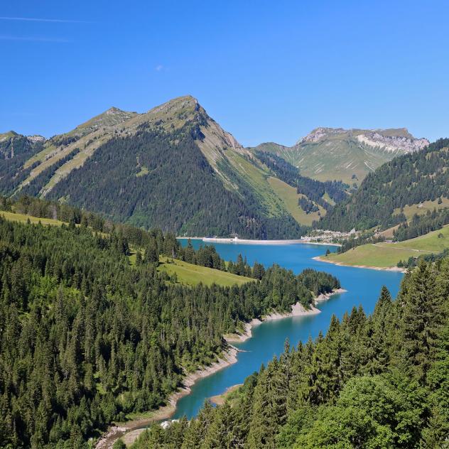
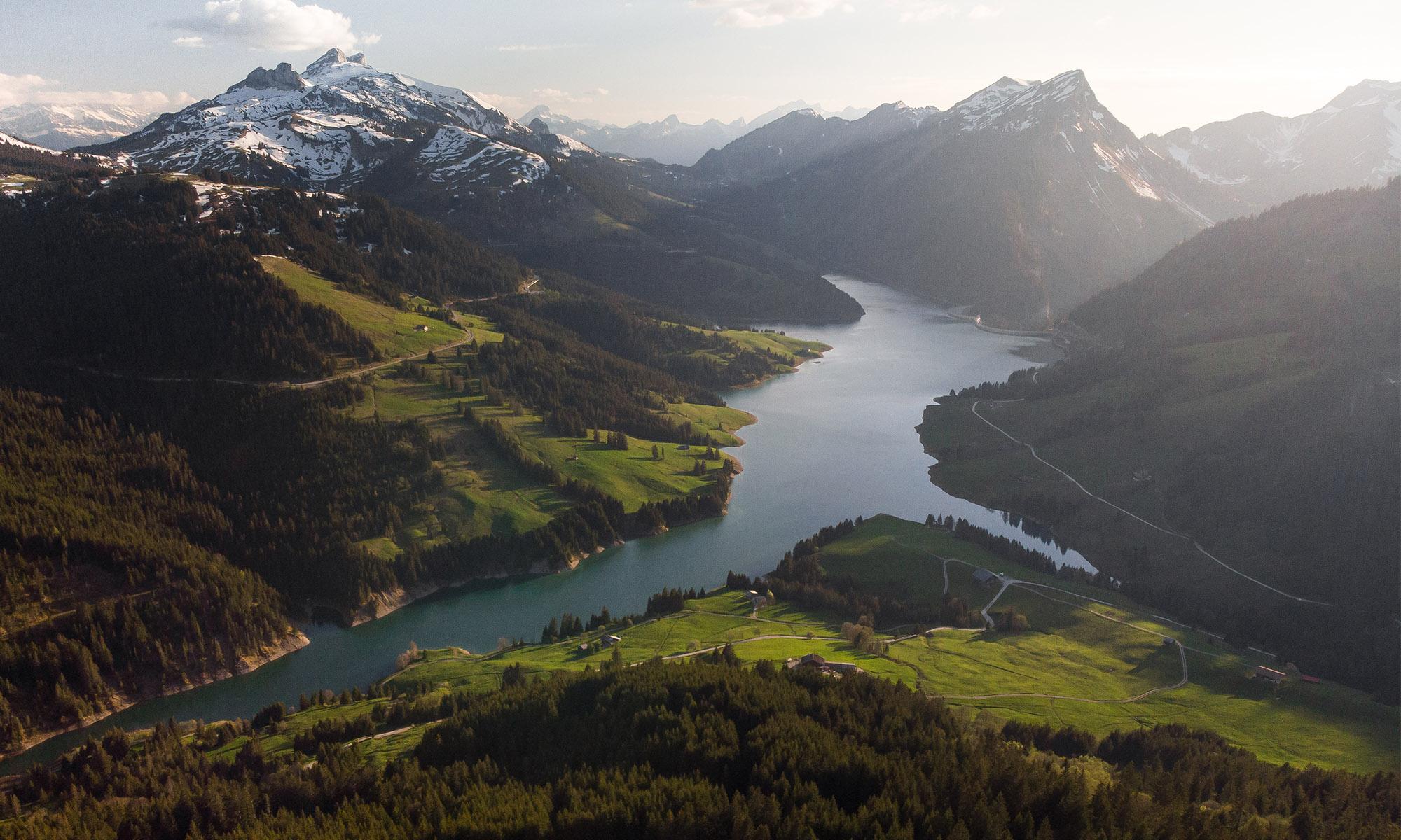
Hongrin lake
Just a stone's throw from Les Mosses and La Lécherette, Lac de l'Hongrin is a peaceful, photogenic spot nestled in the heart of the Vaud Alps.
Description
This loop is ideal for those who want to learn to ride a road bike or get back into the saddle after the winter. On your way, you will cross two lakes and their dams, six rivers and two impressive gorges.
The first part of the route to L'Etivaz is a warm-up ride. Between the Sarine river a...
Practical information
Gravel crossing after the Hongrin dam
Along the route
Rossinière
The village of Rossinière will charm you with its architectural landscape and its secrets.
Cheese cellars of L'Etivaz AOP
The cheese cellars, located in l'Etivaz, allowed you to learn all about the secrets of the production of the precious L’Etivaz AOP alpine cheese.
Hongrin lake
Just a stone's throw from Les Mosses and La Lécherette, Lac de l'Hongrin is a peaceful, photogenic spot nestled in the heart of the Vaud Alps.
Links
Along the river Pictures

Useful information and contact
Coming to Pays-d'Enhaut
Brochures and maps
- location_on
Pays-d'Enhaut Région Économie et Tourisme
Chemin des Ballons 2
1660 Château-d'Œx
- phone_in_talk
+41 26 924 25 25
- mail
info@pays-denhaut.ch

Facebook

Instagram

